

When you grow up with something, it is easy to assume that everyone knows what you are talking about. Somerset rhynes were such a familiar sight in my childhood that I forget that others may not be familiar with them. This blog will hopefully set that right in words and pictures ahead of the next time that I write about my botanical field trips beside rhynes.
Rhynes form a network of water-filled channels within the low-lying, man-made environment of the Somerset Levels. You may remember that they made the national news in early 2014 due to flooding in the Glastonbury area. The above photo shows a ‘crossroads’ in a network of rhynes that are close to the full mark. The picture below shows a similar rhyne after the long period without rain this summer. It illustrates how steep the banks can be and how far a rhyne can drop below the flat agricultural land on either side.

Word Origin
Rhyne is an old Somerset dialect word. You may come across the term spelt differently in other regions: rhine or reen. There are numerous closely spelt words of Scandinavian, Germanic or Indo-European origin meaning to flow or move.
- Rean: a deep furrow in a ploughed field
- Rain: it could mean a strip of uncultivated land marking a boundary (as well as water from the sky)
- Rone: a boundary strip
- Rune: a watercourse.
The European river names of the Rhine and Rhône come from the same source. A Somerset rhyne seems to link many of the different levels of meaning. It is a deep furrow, a boundary and a watercourse. Farmers use rhynes to drain land that would otherwise be too boggy for farming. Some land remains susceptible to flooding and is often allowed to flood in winter.
The Somerset Levels
The Somerset Levels act as the water catchment for a much larger area than their own land mass. Much of the Somerset’s moorland lies at, or below, sea level. Many areas lie below the spring high tide in the Bristol Channel. There may be huge, future consequences for the area as the sea level rises due to climate change. Today, the area is prized by farmers for its agricultural land and by birdwatchers for the wide range of birdlife in local nature reserves. There are also otters, voles and rare invertebrates to interest other naturalists.
Archaeology
Archaeology has revealed that the land has been exploited, changed and managed by humans for 10,000 years. There are rich archaeological finds, such as prehistoric trackways and lake villages. The building of the Sweet Track has been dated back to the spring of 3806 BC – the start of farming in the Neolithic age. The wet peat preserved these exciting archaeological finds.
Drainage
Much past drainage was carried out in the past by the Church: either by Glastonbury Abbey or the Dean of Wells and Bishop of Bath and Wells. Rivers were rerouted. The Dissolution of the Monasteries by Henry VIII brought an end to the Church’s management of the land. It wasn’t until the 18th and early 19th centuries that the land evolved into today’s network of rhynes, ditches and drains. I was lucky to visit an old pumping station at Westonzoyland in 2019. One of the unfortunate consequences of drainage is that the land drops even further below sea level and it therefore fell out of use.
Gallery of Images


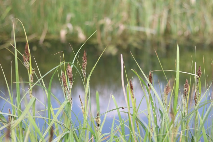
The soggy terrain and rhynes give botanists an opportunity to search for wetland species including sedges. The water quality and flow influences the type of specimens found as observed in previous blogs.
© Karen Andrews
References and Further Reading
- Avalon Marshes (?): The Sweet Track & Other Trackways.
- BBC News (2014): What are the Somerset Levels? 7 February 2014.
- Natural England (2013): Somerset Levels and Moors (NE451). NCA Profile:142. Access to Evidence.
- Natural England (2013): Somerset Levels and Moors. National Character Area Profile 142. Download from above link.
- Quinion, Michael (1996-onwards): Rhine. World Wide Words.
Copyright Note
Karen does not seek or receive any commercial interest or advantage from this blog. She is not promoting any business venture. She simply loves to share fascinating facts about plants. These pages illustrate her love of plants, botany, biodiversity, gardens and creative expression. There is always so much to learn about plant diversity. This blog is designed as a showcase for photography, commentary on plants and wildlife, gardens and other places visited, horticulture and related topics. Viewpoints are her own, not those of her employer.
© Karen Andrews 2018 onwards. All rights reserved. Unauthorized use and/or duplication of this material without express and written permission from this blog’s author and/or owner is strictly prohibited. Excerpts and links may be used, provided that full and clear credit is given to Karen Andrews and BotanyKaren.net with appropriate and specific direction to the original content.
1 thought on “What is a Somerset rhyne?”
Comments are closed.